Our Dalen and Erlandson Ancestry
https://en.wikipedia.org/wiki/Lesja
Lesja>
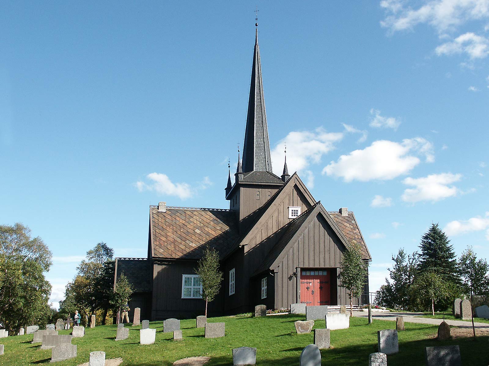
is a municipality in Oppland county, Norway. It is part of the traditional region of Gudbrandsdal. The administrative centre of the municipality is the village of Lesja. The parish of Lesje was established as a municipality on 1 January 1838 (see formannskapsdistrikt). The area of Dovre was separated from Lesja to become a municipality of its own in 1861.
The area is first mentioned in the written chronicle of the Heimskringla (The Chronicle of the Kings of Norway) by Snorri Sturluson. The account of King Olaf's (A.D. 1015-1021) conversion of Dale-Gudbrand to Christianity is popularly recognized. King Olaf's success was short-lived, for in 1029 the Norwegian nobles, seething with discontent, rallied round the invading Knut the Great, and Olaf had to flee. To avoid engaging a fleet of 25 ships, 400 of King Olav's men and 100 loyal peasant farmers from Romsdal built a road up from the Romsdalfjord which passed through the area that became known as Lesjaverk. His men fled along this road and across Gudbrandsdal. There he was not warmly received since he had killed King Thorer of Gudbrandsdal, so he went on to Hedmark. From there he proceeded to Sweden and on to Russia. On his return a year later he fell at the Battle of Stiklestad.[5]
Emigration from Lesja
The Lesja area in the Gudbrandsdal was source of numerous emigrants to America. According to Du Chaillu, "...during the great famine of 1867; a year memorable in the annals of Northern Europe, when, in consequence of an early and heavy frost in summer, the crops were destroyed, and desolation and death spread over vast districts. The lichen and the bark of the birch tree, mixed with a little flour, became the food of the people after the cattle had been eaten up and nothing else was left. The year following a strong tide of emigration set out for America."[8]
[8] Du Chaillu, Paul B. (1899). The Land Of The Midnight Sun. London: George Newnes, Limited. p. 123.
Geography
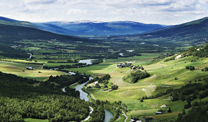
Lesja is highly mountainous, and lies on the east-west watershed, with Lesjaskogsvatnet lake draining both west to the Rauma river and east to the Gudbrandsdalslågen river. The largest part (82%) of the community area is over 900 metres (3,000 ft) above sea level, with the highest mountain peaks reaching above an elevation of 2,200 metres (7,200 ft) in the northeast. The most populated areas lie between 500 and 650 metres (1,640 and 2,130 ft) along the Gudbrandsdalslågen river and highway E136. Abundant summer farms (seter or sæter) are situated close to the treeline, both in the main valley and its tributaries. The summer farms were of major importance for farming until recently, but today only few are used in the traditional way, and mainly as grounds for grazing dairy cattle and sheep. More than 400 lakes are situated within the municipality, mainly above treeline. The Norwegian trout is common both in lakes and rivers, even in lakes above 1,500 metres (4,900 ft) above sea level. The landscape is hummocky in general, and owes its appearance mainly to erosion by the Scandinavian Ice Sheet during the last glacial period.
Lesja, Oppland, Norway